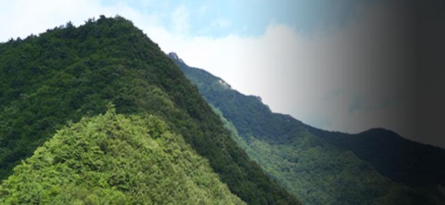
The southernmost peak of Sobaeksan National Park, Myojeokbong
This is the southernmost mountain of Sobaeksan National Park, a mountain on the Baekdudaegan Ridge that borders Daegang-myeon and Pungi-eup, Yeongju. Because Sobaeksan National Park is considered to have extended northward from Jukryeong, Doseolbong Peak and Myojeokbong Peak (1,148 meters) south of Jukryeong are not considered to be part of Sobaeksan National Park, so they are relatively uncrowded.
The Sadong-ri Village, the starting point of the hike, is said to have been inhabited by the Donghak army, who were chased by the national army during the late Joseon period. The valley is deep and beautiful. Overshadowed by the fame of its neighbors, Myojeokbong stands alone at the southernmost tip of Sobaeksan National Park.
Hiking Course
- Approximately 6 hours / 13 kilometers
- Sadongmaeul Village (vacant lot) (20 min/1.0 km) → Three-way intersection (50 min/1.0 km) → Tomb (70 min/2.0 km) → Dosolbong Peak Anbu Crossing (10 min/0.3 km) → Dosolbong Peak (50 min/2.0 km) → Summit (30 min/0.6 km) → Myojeokbong Peak (130 min/6.1 km) → Sadongmaeul Village
Map
- Address
- Sadong-ri, Daegang-myeon, Danyang