The holy mountain of the people, rising in the center of the Korean Peninsula with the spirit of the people, Sobaeksan Mountain
(Sobaeksan National Park/Natural Monument)
Some say it's a mountain that saves people, others say it's a mountain of wind. Sobaeksan Mountain, which means different perceptions depending on the viewer, is the famous mountain of the people that preserves the grandeur and mystery of the Baekdudaegan, standing tall in the center of the Korean Peninsula. It is a mountain of gentleness, starting with Hyeongjaebong Peak and extending along the southern mountain range to Sinseonbong Peak, Gookmangbong Peak, Birobong Peak, and Yeonhwabong Peak. Sobaeksan Mountain is bordered by three provinces: Danyang in Chungcheongbuk-do, Yeongju in Gyeongsangbuk-do, and Yeongwol in Gangwon-do.
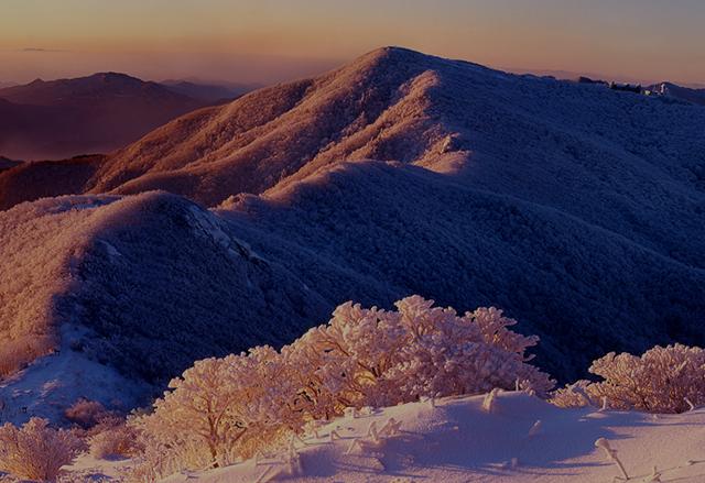
It is said that Gyeogam Nam Sago, a scholar in the mid-Joseon Dynasty, was so moved by the mountain that he even bowed to it as a mountain that saves people. In spring, it blushes with royal azaleas, in summer, it blows its leafy hair coolly in the wind, in autumn, it dresses up in fine maple robes, and in winter, it covers the entire mountain with white snow and shows off its majesty.
Therefore, every time you climb Sobaeksan Mountain, it feels different. In particular, the winter hike, with its snowflakes sparkling in the sunlight and yew clusters dressed in pure white, is one of the greatest pleasures of climbing Sobaeksan Mountain.
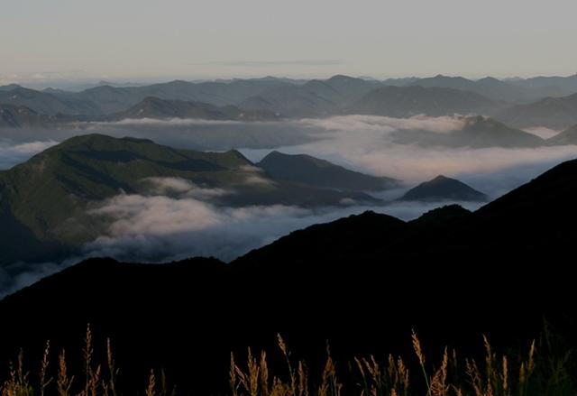
Sobaeksan Mountain Gukmangbong Peak with the clouds (1,420 meters)
From Gukmangbong, the ridges of Sinseonbong and Hyeongjaebong Peak to the north, Munsusan Mountain and Seondalsan Mountain to the east, Yeonhwabong Peak and Dosolbong Peak to the south rush into the view like waves, and the nearby Birobong Peak to the west, the ridges seem to be surging with tidal waves, forming a panoramic spectacle.
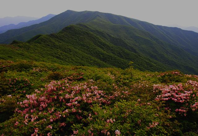
Birobong Peak, the main peak of Sobaeksan Mountain (1,439 meters)
As the main peak of Sobaeksan Mountain, it is famous for its colonies of edelweiss, a rare plant, and yew, which was used for royal furniture. In spring and summer, the wide meadows at the summit, where trees cannot grow due to strong winds, resemble a scene from a Western movie. In winter, rainbow-colored snow flurries, snowflakes reflected in the morning sun, and the white plains make winter hiking the ultimate experience.
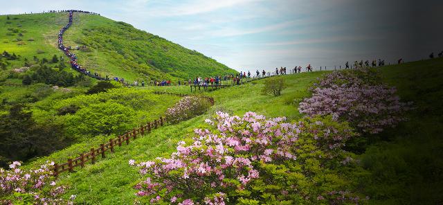
Yeonhwabong Peak (1,394 meters): Full of flower clusters, snowy Sobaeksan Mountain, and crowds at sunrise
Covered in royal azaleas, the Sobaeksan Azalea Festival is held here every year, and the blend of light pink azaleas and jubilant hikers is often spectacular. It is the cradle of Korean astronomy, home to the country's first astronomical observatory (1974) and communication center, and the meeting point of hiking trails from several branches of the Sobaeksan Mountains. Here, you can dream of becoming a god and flying in the clouds.
There is Yeonhwabong Peak, 1st Yeonhwabong Peak, and 2nd Yeonhwabong Peak, and the 2nd Yeonhwa Peak shelter is the most organized shelter in Korea.
- Sinseonbong Peak (1,389 meters), a tricky peak open to gods
- If you look north at the upper Namhangang River, which forms the border between Danyang, Chungcheongbuk-do, and Yeongwol, Gangwon-do, you will see Sambong Peak and Suribong Peak standing tall, starting from the east, and then pass through Hyeonjaebong Peak and Madanggogae Hill to reach Sinseonbong Peak. It is said that Shinseonbong Peak was named because it has a checkerboard of gods, and it is difficult to cross and difficult to climb, so it is said to be a place where only gods can go. If you sit on the checkerboard rock, you will feel like you are floating in the clouds.
- The Hyeongjaebong Peaks (1,177m), facing each other
- The peaks are called Hyeongjaebong (Brother) Peaks because they are facing each other, and it is said that there were many feng shui practitioners in the Joseon Dynasty because it was known as a place where a fairy comes down and weaves silk) in feng shui theory.
Hiking Course 1
- Approximately 4 hours and 30 minutes/10.1 km
- Gagoksaebat Field (130 minutes/4.7 km) → Eouigok Three-way intersection (10 minutes/0.4 km) → Sobaeksan Mountain Birobong Peak (120 minutes/5.0 km) → Darian Local Tourist Site
Hiking Course 2
- Approximately 4 hours 30 minutes / 11 km
- Cheondong/ Darian Local Tourist Site (130 min/4.5 km) → Campground (50 min/1.7 km) → Three-way intersection (20 min/0.6 km) → Sobaeksan Mountain Birobong Peak (70 min/5.1 km) → Gagoksaebat Field
Hiking Course 3
- Approximately 7 hours 30 minutes / 16.5 km
- Jukryeong Rest Area (130 min/4.3 km) → 2nd Yeonhwabong Peak (70 min/2.7 km) → Observatory (60 min/2.0 km) → 1st Yeonhwabong Peak (70 min/2.5 km) → Sobaeksan Mountain Birobong Peak (120 min/5.km) → Darian Local Tourist Site
Map
- Address
- Gagok-myeon, Danyang